Digital Aerial Mapping (with Certified Remote Pilot Services) RCOC-B Certified by Civil Aviation Authority of Malaysia (CAAM)
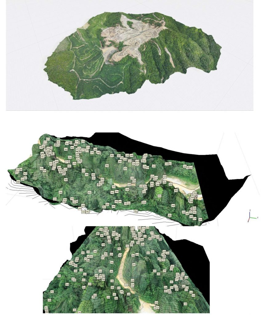
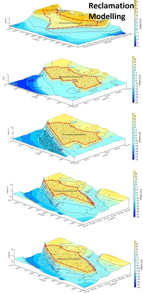
Advance 3D Model Generation with Analysis
3D Terrain Mapping Generation with Flood Analysis
3D Watershed Analysis
Slope Classification
"The information provided on this website is for general informational purposes only. We make no representations or warranties of any kind, express or implied, about the completeness, accuracy, reliability, suitability, or availability with respect to the website or the information, services, or related graphics contained on the website for any purpose. Any reliance you place on such information is therefore strictly at your own risk. In no event will we be liable for any loss or damage including without limitation, indirect or consequential loss or damage, or any loss or damage whatsoever arising from loss of data or profits arising out of, or in connection with, the use of this website."